The spread of Islam into Asia, bringing with it a diverse range of Muslim, Greek, and Latin intellectual traditions, resulted in a variety of maps that intermingled cultures, languages, and geography. Nowhere can this diversity be seen more vividly than in this late 18th century Indian world map. Although its creator is unknown, based on the exquisite vignettes covering the work it appears to have been made by a miniaturist. The map is typical of the style of painting found in the 18th century in Rajasthan in the west of India or in the Deccan plateau to the south, its linguistic diversity also points to these regions as its source: it features descriptions written in Arabic, Persian, and Hindi (in the Devanagari script).
This particularly beautiful and eclectic world map, probably dating from around 1770, is currently in the Museum für Islamische Kunst in Berlin. While obviously not produced during the early medieval period, it is also obviously very similar in design of the following medieval maps: Psalter #223, Hereford #226, Ebstorf #224, and ‘Umari #226.2. It is a large map, measuring 260 x 261 cm (8’6.25” x 8’6.75”), painted in tempera on cloth, and is richly illustrated with miniature depictions, largely - but not entirely - of scenes from the Iskandarnamah, a mythologized and widely disseminated account of the exploits of Alexander the Great, the origins of which date back at least to the middle of the fourth century. On stylistic grounds the painting is thought to originate from either the Indian Rajasthan or the Deccan; in both areas, schools of miniature painting were particularly well developed. A remarkable feature of the painting is the diversity of languages and scripts used for the map text. The descriptive geographical text is in Arabic; some names of countries and towns are in Persian; and in India the place-names are in both Arabic and Devanagari scripts. The use of the latter suggests that Hindu artists might have been employed by Moslem patrons in its production. Knowledge of Persian and the Arabic scripts was not uncommon among educated Hindus in 18th century India, whereas this did not hold for Muslims and the Devanagari script.
Although like many Arabic maps this one is oriented with South at the top, the depiction of the earth on this Berlin map is essentially Ptolemaic. Knowledge derived from the 15th century pilot Ibn Majid, whose no longer extant work Asra al-bahr [Secrets of the Sea] is cited on the map. (Whether such a work existed is problematic in that Ibn Majid’s known writings never mention the title in question.) Also included on the map is information from European contacts since the time of Vasco da Gama. Places noted in Europe (close to the right edge of the map) include France, Germany and Austria. The name Portugal appears near a red caravel, with an adjacent dinghy, both at anchor in the Indian Ocean, along with misplaced names of several Portuguese islands in the Atlantic Ocean. The largest number of place-names, however, approximately fifty in all, are in South Asia. Calcutta is named, and Amer [Amber] persists in place of Jaipur, which succeeded it as the Kachwaha Rajput capital in 1728, an apparent anachronism. Curiously, the island of Sri Lanka is depicted twice, possibly a throwback to the dual depiction of Tabrobane on some European reconstructions of Ptolemy’s world map (Book I, #119) as well as on Sadiq Isfahani’s (#204). Alternatively, the dual representation may be the result of copying from two different earlier maps, each depicting the island in a different place. There is also an abundance of Middle Eastern place-names.Constantinople is prominently shown by a large rectangle joined to the mainland by a narrow tongue of land. The city is in the shape of a domed kiosk. Mecca is indicated by the black stone of the Ka‘ab. In Africa, the Nile is the most prominent feature. It originates, as on so many Islamic maps, in several streams in the southerly Mountains of the Moon, on which the legendary palace of Alexander is perched, and swings far to the west to join the Mediterranean near Morocco. East (left) of India there appears Japan, shown as a vertical island in which are seated a group of dog-faced creatures; China, along the edge of the earth disk; and rectangles with the names of English and Dutch colonies.
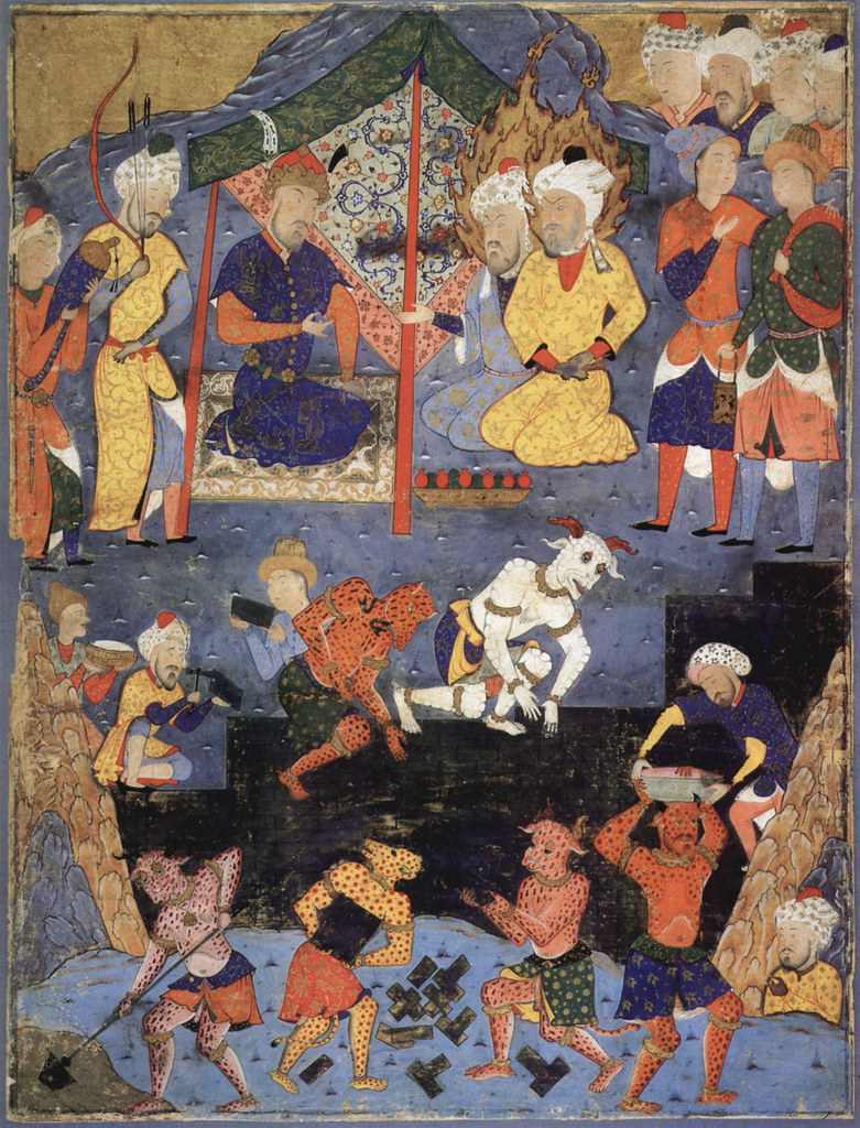
In its depiction of elements from the Iskandarnamah, the Berlin map includes the Spring of Life, whose discovery is attributed to Moses, shown as a black rectangle at the bottom center; the place of Alexander’s meeting with those who sought his help against the people of Gog and Magog; the wall he built for that purpose, to the left of the foregoing; islands inhabited by ape-men; and as already noted, Alexander’s palace on the Mountains of the Moon.
It is interesting to speculate on who commissioned the painting of the Berlin map and why. The chief purpose of the map was very likely ornamental, but one should not rule out an additional didactic motive. No very similar map is known - though that described by Rehatsek has some corresponding features - but it seems likely that comparable productions will eventually come to light.
LOCATION: Museum für Islamische Kunst, Staatliche Museen Preussischer Kulturesitz, Berlin, Germany
REFERENCE:
*Harley, J. B., The History of Cartography, Vol. Two, Figure 17.4 and Plate 29.
*Brotton, J., Great Maps, pp. 176-179.
Eclectic world map, detail, India and adjacent areas. The vignette along the bottom edge shows Alexander directing construction of a wall to protect against the giants Gog and Magog. The large vertical island (upper left), within which one sees dog-faced people, is Japan.
An eclectic world map,tempera on cloth, oriented with South at the top, 1770,
260 x 261 cm (8’6.25” x 8’6.75”)
Museum für Islamische Kunst in Berlin
260 x 261 cm (8’6.25” x 8’6.75”)
Museum für Islamische Kunst in Berlin
Key to the following detail segments from J. Brotton’s book.
Mecca and the Kaaba.
Islam’s holy sites are shown in great detail. Most of the Arabian peninsula is taken up depicting Mecca and the surrounding mountains. At the very center is the “Kaaba”, lying at the heart of Al-Masjid Al-Haram, Islam’s holiest site. Its architecture is shown with some precision.
Islam’s holy sites are shown in great detail. Most of the Arabian peninsula is taken up depicting Mecca and the surrounding mountains. At the very center is the “Kaaba”, lying at the heart of Al-Masjid Al-Haram, Islam’s holiest site. Its architecture is shown with some precision.
Life on the Nile.
Along the Nile River everyday life combines with legend and myth: elephants roam and locals eat and farm, with the river’s source ends in the fictional Mountains of the Moon, on which Alexander’s legendary palace perches.
Along the Nile River everyday life combines with legend and myth: elephants roam and locals eat and farm, with the river’s source ends in the fictional Mountains of the Moon, on which Alexander’s legendary palace perches.
The Portuguese in India.
European influences can be discerned in the Indian Ocean, where a red caravel and dingy are anchored, identified as Portuguese by a nearby inscription.
European influences can be discerned in the Indian Ocean, where a red caravel and dingy are anchored, identified as Portuguese by a nearby inscription.
The Spring of Life.
The map’s most remarkable feature is the black, rectangular “Spring of Life” in the far north, near the pole. Muslim belief attributed its discovery to the Old Testament’s Moses, although its location here is strikingly reminiscent of the biblical Paradise found on medieval Christian mappae mundi.
The map’s most remarkable feature is the black, rectangular “Spring of Life” in the far north, near the pole. Muslim belief attributed its discovery to the Old Testament’s Moses, although its location here is strikingly reminiscent of the biblical Paradise found on medieval Christian mappae mundi.
Alexander’s Army.
In one of the more explicit depictions of the story of Alexander’s confrontation with the monstrous race of Gog and Magog, the map shows the emperor “with men who asked for his help against the people of Gog and Magog, and the wall built for their defense.”
In one of the more explicit depictions of the story of Alexander’s confrontation with the monstrous race of Gog and Magog, the map shows the emperor “with men who asked for his help against the people of Gog and Magog, and the wall built for their defense.”
India.
The map’s Indian origins give this area topographical detail (more than 50 place-names) although its shape still echoes Ptolemy’s beliefs. Surprisingly Sri Lanka is drawn twice, a remnant of age-old confusion over the mythical island named “Taprobana” in the Indian Ocean.
The map’s Indian origins give this area topographical detail (more than 50 place-names) although its shape still echoes Ptolemy’s beliefs. Surprisingly Sri Lanka is drawn twice, a remnant of age-old confusion over the mythical island named “Taprobana” in the Indian Ocean.
Iberia and Atlantic Islands.
The mapmaker’s confusion over European discoveries is obvious in the Atlantic. Islands discovered by Portugal are named but misplaced, while the tear-shaped land at the top right might even represent America.
The mapmaker’s confusion over European discoveries is obvious in the Atlantic. Islands discovered by Portugal are named but misplaced, while the tear-shaped land at the top right might even represent America.
